NASA Hurricane Images From Space

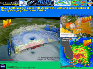
This slide shows different views of the Precipitation-Energy-Winds in Katrina. These satellite images are from the Tropical Rainfall Measuring mission (TRMM), Advanced Microwave Scanning Radiometer (AMSR-E) instrument from the Aqua satellite, and QuickSCAT respectively. Note the high energy content in the northern Gulf of Mexico (reds) prior to Katrina's arrival.
Credit: NASA
 Sunday, August 28, 2005 8:42 a.m EDT
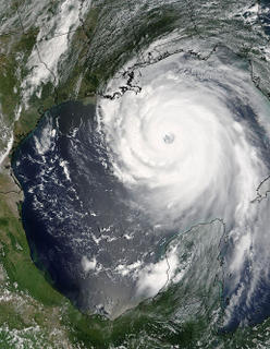
Pretty amazing to look at this monster. The formation of the eyewall is almost overwhelming. I woke my husband up before daybreak to show him that the storm had swelled in intensity from a Category 1 when he went to bed, to a Category 5. We had to wait until daybreak to board the house, move in the plants and "potential flying hazards" from the yard before we could leave. We waffled back and forth between leaving and staying, primarily because our families would not leave, and because we knew how hard it would be to return to the area AFTER the storm was over.
I didn't want to leave, yet I knew better than to stay. I was only 9 when Hurricane Camille hit basically the same area, yet it has left an indellible print in my memory that can never be erased. The "hurricane gauge" used to be Camille...the BIGGIE....but on August 29, 2005, a new gauge and standard was set....Her name...KATRINA.

0 Comments:
Post a Comment
<< Home